stefanchirila
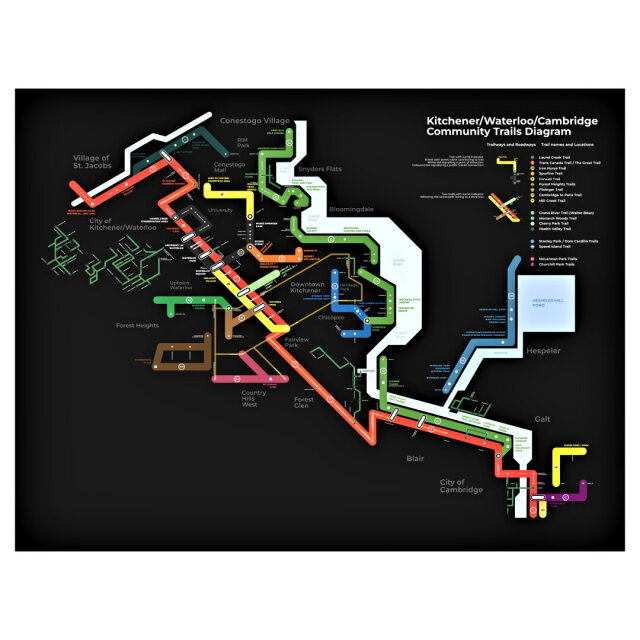
I found someone once made something similar with the cycling trails in Toronto, so I thought I'd do the same for my town. If you're interested let me know I'll send the vector graphic. Font used is open source too, Montserrat.
I found someone once made something similar with the cycling trails in Toronto, so I thought I'd do the same for my town. If you're interested let me know I'll send the vector graphic. Font used is open source too, Montserrat.